One of the joys of living in (most of) Arizona is that visitors and residents can spend plenty of time outdoors in the winter while nearly everyone else in the country has to stay inside. If you’re hitting the trails this season, here are six perfect Arizona hikes for the winter.
From a Sedona trail that offers up breathtaking views of the city’s red rocks to a hike that leads to one of the best viewpoints of all of metro Phoenix, these trails all have something special to offer.
Holbert Trail in Central Phoenix
10919 S. Central Ave. in Phoenix
Sure, you could drive to Dobbins Overlook on the winding two-lane road that weaves its way up South Mountain, but hiking up the iconic Holbert Trail is far more rewarding—albeit much more physically challenging. Drive through South Mountain’s main entrance on Central Avenue and take the first left into the parking lot. After a relatively flat start, the trail ascends, turns right, then gradually increases in elevation for a total change of 1,100 feet. A short detour takes you to Dobbins Overlook, which offers sweeping views of the entire valley and is considered to be one of the best view points in all of Phoenix. Turn back the way you came for an out-and-back hike that’s just under 5 miles.
Crack in the Mountain Trail in Lake Havasu City
7200 Dub Campbell Parkway in Lake Havasu City
Head to SARA Park in Lake Havasu City to tackle the Crack in the Mountain Trail. Follow the yellow or red trail to reach the canyon, which narrows to the width of a person’s arm at one point. There is a series of dry falls, including a 7-foot drop that many hikers simply slide down. The trail ends at a cove that’s filled with aquamarine-colored water and home to Balance Rock, a massive rock formation that appears to be teetering. You might even see bighorn sheep here too. Turn back for a hike that’s a total of 5 miles.
Safety tip: It’s best to avoid this hike before or after a rainstorm as it might flood, turning those so-called “dry falls” into something else entirely. Water also might block your passage through the crack if it’s recently rained. Be sure to check the weather before you take off.
Picacho Peak State Park in Eloy
Interstate 10, Exit 219
Entrance fees: Admission for each vehicle filled with one to four adults costs $7; individual/bicycle admission is $3
If you’ve ever driven from Phoenix to Tucson, you’ve no doubt spotted Picacho Peak State Park from the interstate. Although there are other trails in the park, the classic one is the Hunter Trail. This 2-mile hike leads to a peak that sits at 1,500 feet. Expect a steep and challenging route. You’ll have to use cables to help you reach the top, so gloves are recommended. Your reward? Stunning Arizona views that go on for what seems like forever. Turn around the way you came for a hike that’s 4 miles total and a classic Arizona trek.
Airport Loop Trail in Sedona
Airport Road in Sedona
There’s a small parking lot along Airport Road that leads to the trailhead. At the top of Airport Road, there’s a paid parking lot.
Sedona’s Airport Mesa serves up some of the best views of Capitol Butte, one of Sedona’s most iconic red rock formations. If you’d like to take in those vistas on foot, the Airport Loop Trail is a great way to check out nearly all of Sedona’s red rocks. This trail is relatively flat and has stunning views—making it a great moderate hike for hikers of all skill levels. If Sedona gets snow, those red rocks will be covered in fresh white powder that will make the hike that much more magical. This loop trail is just over 3 miles long. Sedona is usually crowded, but tourism tends to drop off in the winter. The trails should be quiet, or at least quieter than usual.
Buffalo Park
2400 N. Gemini Road in Flagstaff
Flagstaff’s 215-acre Buffalo Park is home to stunning mountain views that are easily accessible via a paved trail. The 2-mile loop trail allows hikers to take in the mountain vistas. If it has snowed, it’s a relatively easy trek that’s made even more scenic with the mountains covered in the snow. This trail is also lined with fitness stations where visitors can perform push-ups and other exercises, if you’re so inclined.
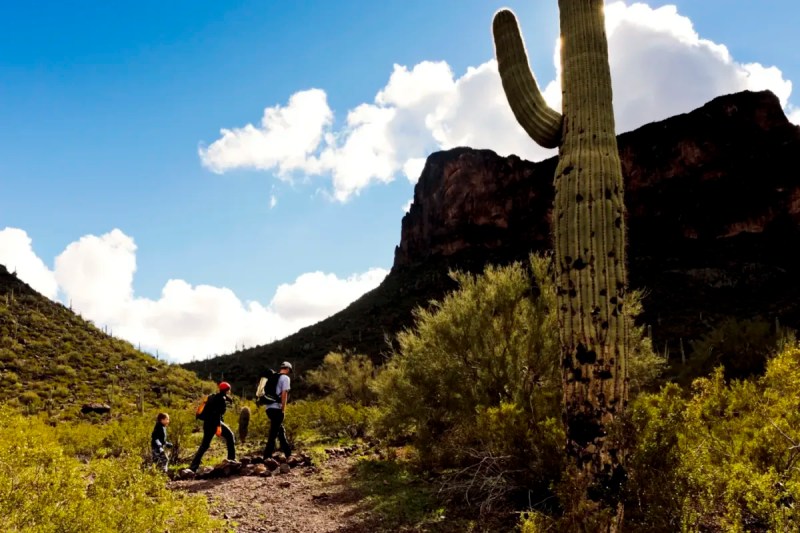
Saguaro National Park
3693 S. Old Spanish Trail in Tucson
The sprawling Saguaro National Park, spread over 91,000 acres in Tucson, is worth a visit to see the abundance of enormous cacti this park is named after. The park is home to a variety of hiking trails that vary in skill level. Take the Sendero Esperanza Trail to the High Norris junction. The trail is mostly flat but then climbs up 220 feet in elevation via switchbacks. At the top of this ridge, you’ll take in stunning views. If you’re up for a real challenge, you can hike up to Wasson Peak, which stands at 4,687 feet. This trail is about 8 miles long and is a tough challenge. Your reward? Some of the best views of Tucson.
Editor’s note: This story was originally published in 2023 and updated in 2024.